"Villa Gallo-romaine de Moulon" archaeological site (gallo-roman villa of Moulon) ("Lieu-dit La Mare Champtier")
In 1992 and 1993, at the moment of the construction of "la Maison de l'Ingénieur" of the
Paris-Sud university, in the towns of Gif sur Yvette and
Orsay (France - Essonne), the team of volunteer archaeologists of the cultural association of the
"Commissariat a l'Energie Atomique et aux Energies Alternatives" (AAC - CEA, Saclay) uncovered a set of
previously unknown archaeological vestiges. The site is located 23 km to southwest of Paris, on the
southern edge of the "Plateau de Saclay", on the campus and owned by the University of
Paris-Saclay.
Several occupation ages have been identified here (Neolithic, Bronze age, Gallo-roman/Romano-gallic and
Medieval).
Excavations were undertaken by the CEA team from 1994 to 1998 on a plot located to the east of the Maison de l'Ingénieur (which became Polytech Paris-Saclay) and lie fallow land for several decades. These excavations uncovered the remains of a Gallo-Roman building built at the beginning of the 2nd century AD and abandoned at the end of the 3rd century. This chronology is mainly based on the architectural aspect and on the study of the collected objects, carried out at the AAC-CEA Archaeology Laboratory : pottery, architectural elements, tools and ornaments in bone or metal, coins, glass objects, decorative elements including fragments of wall paintings...
The architecture of the building is typical of this period. Built of durable materials for
masonry (mainly millstone and sandstone extracted from the surrounding subsoil), equipped with a flat
and round tiled roof, it is the residential part of a Gallo-Roman villa (pars urbana),
occuped by the owner. It included rooms heated by the floor
(hypocaust heating system).
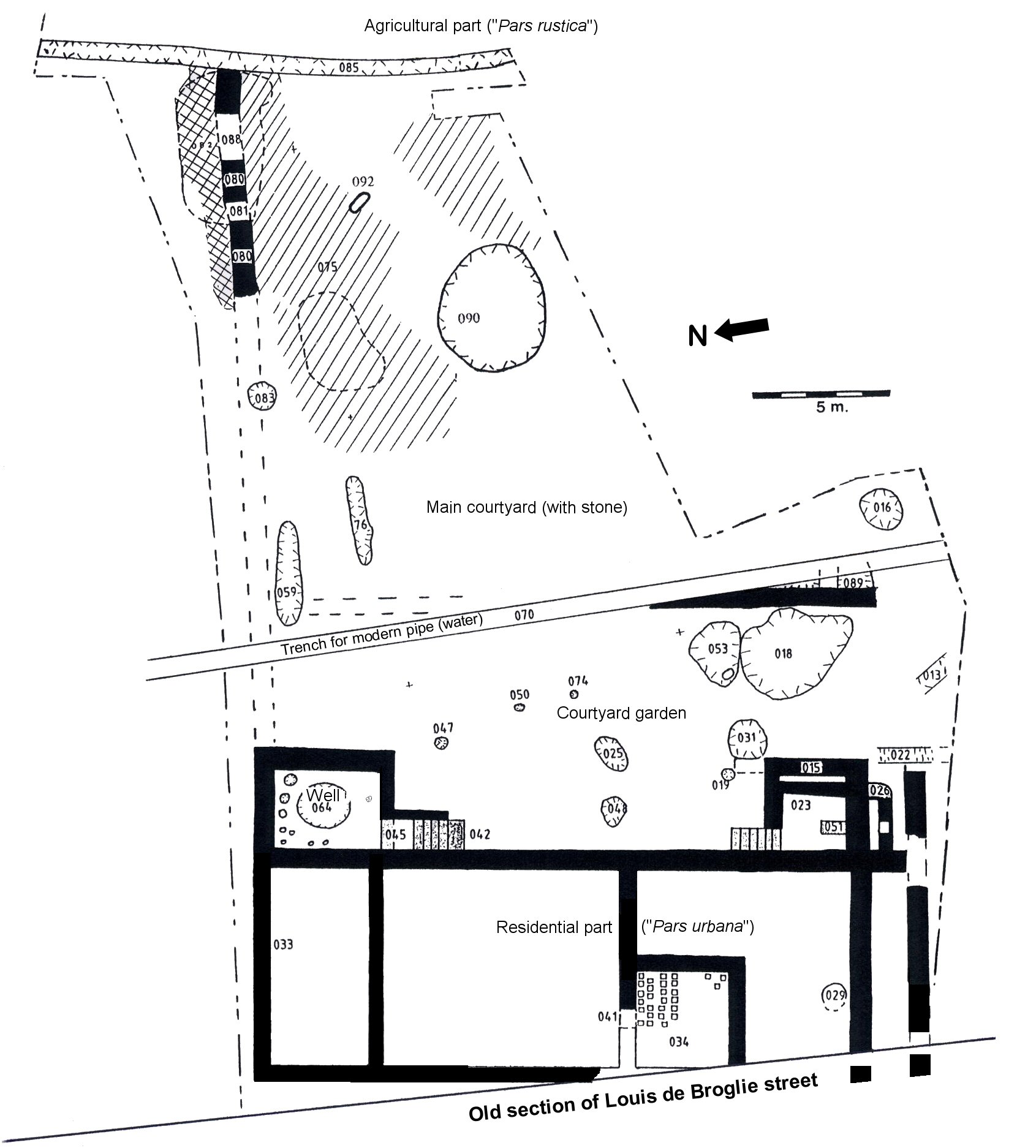
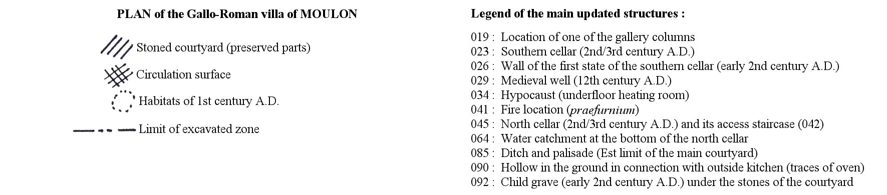
Two cellars located at the north and south ends were topped by a ground floor and a first floor. These
two cellars were each located in a corner pavilion, connected to a gallery on the east facing facade. In
the north cellar, a central well surrounded by poles holes indicates the presence of a wooden floor
probably equipped with a trapdoor to draw water. At the time of discovery of this well, we was able to
still draw there for almost 400 liters of water by day.
The building's footprint has a surface area of nearly 300 m² on the ground. Occupied by the
owner and his family, this house has a water supply, central heating and a certain comfort, but it is
nevertheless without ostentatious luxury. Together with its surroundings, it corresponds to an
agricultural domain of medium importance.
A Gallo-Roman agricultural operation is based on the fundus, a private land domain, which in
principle includes all the land that allows the occupants to live together in self-sufficiency. In the
centre of the estate is the villa, which is organised into several utility buildings. Built
most often according to a more or less standardized geometric plan, the Gallo-Roman villa
includes the owner's dwelling (pars urbana) and the required buildings for the agricultural
exploitation (pars rustica). It is a testimony to the ease of the ruling class of the time
(wealthy "businessman", high-ranking civil servant...) and the production of such an architecture made
possible by the pax romana promoting economic activities and the constant evolution of
technology.
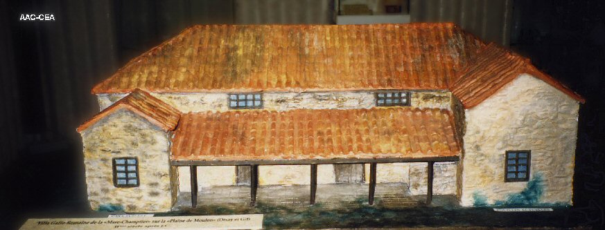
This villa in Ile de France was not a simple farmhouse without any pomp and decorum. The walls of some rooms were decorated with wall paintings. Comfort (water supply, heating...) and refinement in the Roman style were now within the reach of some rural owners at the head of the villae, generating substantial income (livestock, cultivation of the land...).
On the east side, in front of the facade gallery, there was a courtyard garden on the edge of which a low wall separated the residential part (pars urbana) from the main courtyard. This one presents some vestiges, in particular the burial of a young child, a wall of large stone blocks, a palisade ditch, outdoor kitchens... The excavation of this courtyard has also brought to light traces of older dwellings (first half of the 1st century AD) built in light materials (probably wooden and adobe walls or cob and enchanting roofs).
Further east, in an area of one hectare cleared in October 2013, was the agricultural part
of the villa (pars rustica) where several farm buildings were built : grain granaries,
barns, cellars and cellars, sheepfolds and pigsty, stables but also craft workshops and probable housing
for the intendant and workers... Although very partially excavated for a few days in November 2013
(archaeological diagnosis conducted by the National Institute of Archaeological and Preventive Research,
INRAP) this sector has revealed many structures in connection with the residential part of the
villa. Two buildings of approximately 130 m² were identified. These are typical Gallo-Roman
barns, built "in hard". They have the same orientation as the building of the residential part located
nearby. This diagnosis also made it possible to identify two partially excavated Gallo-Roman
cellars.
Unfortunately, following the archaeological diagnosis, the conclusions of which proposed to understand
the ancient occupation of the land through an in-depth excavation carried out by specialists, the entire
area could not be recognised and excavated. Three years after, the construction of several buildings in 2016 and 2017 and
the creation of a new street (rue Sophie Germain) have not made it possible to preserve installations
certain of the Gallo-Roman villa estate, as well as the identified medieval occupations.
Nevertheless, some structures have been preserved, notably under pavements, streets and between of
buildings. They could be the subject of possible archaeological excavations during future work in this
area. The continuation of archaeological research in this area would have made it possible (and will in
the future) to study a subject that is rarely conduct in the Ile de France region, due to a lack of time
and resources: the agricultural sector of a Gallo-Roman villa.
The Gallo-Roman villa of Moulon was abandoned around 270/280 AD, probably for serious socio-economic reasons, in possible link with unsettled state of climatic conditions (bad harvest...). At that time, Roman Gaul suffered numerous invasions, which eventually forced the population living on the villa to reach more secure places. Beyond regulary damaged installations and probably repeated crop failures, the disorganization of society was undoubtedly at the origin of the abandonment of entire territories. Moulon's villa was only reoccupied in the Middle Ages. From the 11th to the 13th century, a human occupation was identified in the ruins of the villa. Building material reclaimers ? To build neighbouring villages, such as Saint-Aubin in the west or Saclay in the north ?
In Gallo-Roman times, the Saclay Plateau was located on the territory of the
Parisii, whose southern geographical limit corresponds to the Yvette Valley. In contact with
the border areas of the Carnutes (west) and Senons (south) communities, the whole area is under the
jurisdiction of the province of Lyonnaise. The nearest major cities are Paris, Chartres (Autricum), Evreux (Mediolanum) and Dreux (Durocasses). The medium-size vicus identified today are (Diodurum, 78), Etampes (Stampae, 91), Ablis (Avallocium ?, 78) and Dourdan (Dordincum, 91).
The territory of Orsay was attached to the fiefdom of Palaiseau during the early Middle Ages, then
transmitted by the Pépin le Bref king to the abbey of Saint Germain des Prés (Paris) in 754. It became
the property of Notre-Dame de Longpont's abbey (Longpont sur Orge) in the 11th century, in 1080 on the
order of the bishop of Paris. In 1151, the monks found a priory and at the beginner of the 13th century
build the Saint-Martin church. For Orsay (Orceacum, Orceacus, Orceiacus ou Orceicus),
the oldest handwritten mention identified to date would date from 999.
As for the territory of Gif sur Yvette, also owned by the abbey of Saint Germain des Prés (Paris) during
the early Middle Ages, it was subsequently owned by a benedictine abbey from the 11th century.
Enhancement of the archaeological site
As early as 1994, the presentation to the public of the remains of the Gallo-Roman villa of Moulon aroused great interest among the population. Noting this attachment to the ancient history of the region, which has developed over the years, the municipalities of Gif sur Yvette, Orsay and the Plateau de Saclay intercommunality (now the Communauté d'Agglomération Paris-Saclay) proposed in 1995 to conserve this local resource. In order to make the villa accessible to the public, a project for the enhancement of the vestiges and a development with information supports was established. The archaeological site was not filled in after the excavations. Since 1995, several requests for rehabilitation were presented, notably in 2000, when a grant-subsidy was voted by Gif sur Yvette, Orsay and the intercommunality for the enhancement of the Gallo-Roman villa, which was not followed through (see Communaute d'Agglomeration Paris-Saclay - CAPS "Territoire et Patrimoine").
After almost 25 years, finally in 2018, a concrete development was born, led by the EPAPS
(Etablissement Public d'Aménagement du Plateau de Saclay) and the local authorities. Despite the
constraints generated by the health crisis (CoViD 19), fieldwork was initiated in the spring of 2021.
As a non-renewable cultural asset, the remains have benefited from consolidation of the masonry in order
to considerably reduce their deterioration. These few elements of the local archaeological heritage are
now partly preserved.
For 2021 october, the visitors can appreciate the results of this work.
In accordance with the rules which are imposed for an inevitably fragile archaeological
site, it remains now to concretize the renewal of the protection of access to the site. Access
protection that could be integrated with the modern architecture of the district. Associating modern and
ancient architecture!
For the cultural mediation part of the site, it also remains to concretize the information supports to
be set up in the immediate proximity of the site, for facilitate the understanding for the visitors, in
absence of speaker guides (nevertheless in place the week-end or with meeting).
Within the framework of events such as Les Enfants du Patrimoine or the Journées du
Patrimoine, we have welcomed the public on the site of the villa. Many classes from the
surrounding schools came to visit the site, which is referenced on maps.
Each time, we met a great enthusiasm from the public. Of the many questions asked, some come up
frequently, concerning the future of the Gallo-Roman villa, the type of proposed enhancement
and the possible continuation of archaeological research on the site. The courtyard in front of the
residential part of the villa, as well as the northern and southern approaches, were not
excavated in their entirety. The same was true for the agricultural part of the estate located further
east.
Several television reports were made on the site, notably by the local channels Telessonne and TV78.
All these arguments incite, really, to safeguard and to develop these unique vestiges in
the department of Essonne and thus to participate in the preservation of our collective memory. All the
more so as it is the only visible and comprehensible example in the south-western region of the Ile de
France (region of Paris).
In metropolitan France, it would be the only archaeological site present on a university campus
(university of Paris-Saclay).
We remain vigilant about the future of the archaeological site and listen to the proposals of specialists and the population to enable the preservation of this local heritage.
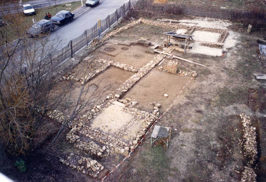
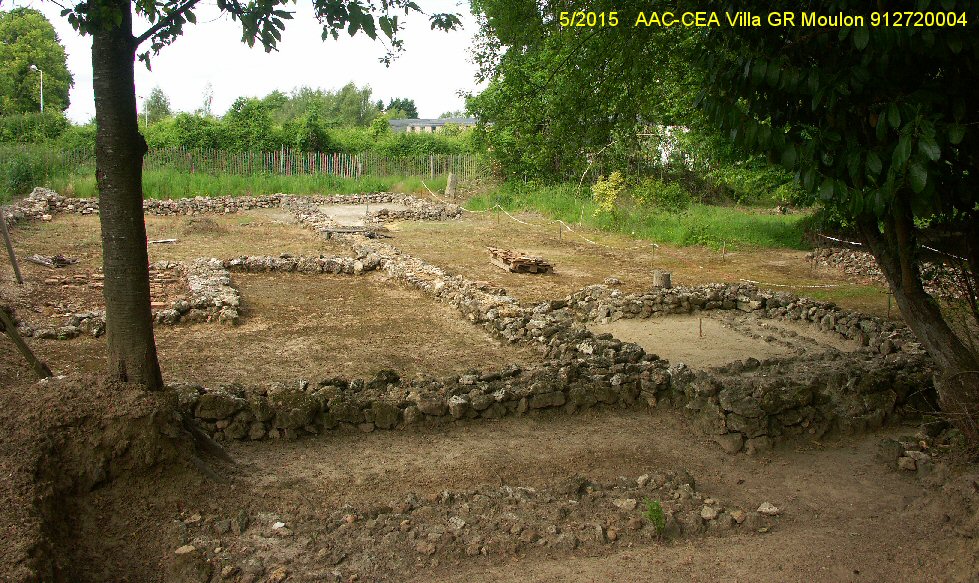
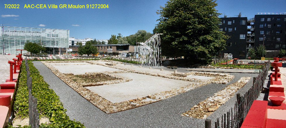
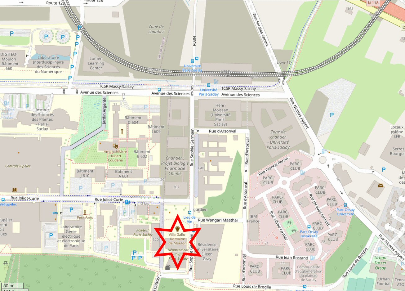
The visible remains of the villa are in Orsay, on the plateau de Moulon, near
of the RN118 road.
Campus of Paris-Saclay, located east of Polytech Paris-Saclay (Maison de l'ingénieur).
Place Hubert Coudane, near of Sophie Germain street (near of old section of Louis de Broglie
street).
France 91 Orsay (at the immediate limit of Gif sur Yvette)
Parking spaces near, proximity of a University caretaker's residence
GPS coordinates : Longitude = 2° 10' 19.5" E --- Latitude = 48° 42' 32.9" N
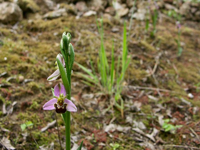
Two animal species that are not uncommon to find in the summer months :
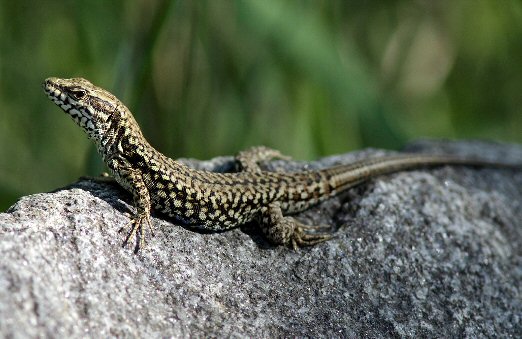
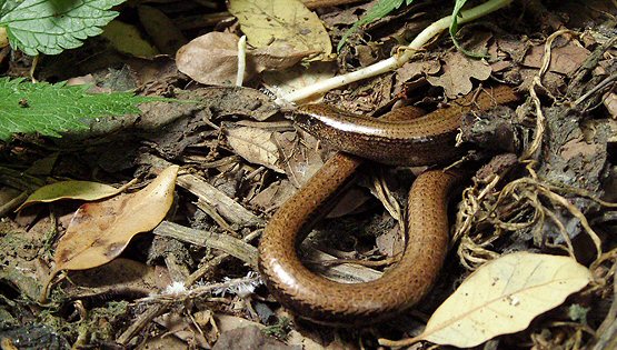
The orvet ? A small lizard disguised as a harmless snake with movable eyelids that allow it to blink !
« A fake pink flower, a fake insect with fake legs with fake hair, fake eyes and fake antennas. We are also told that it emits a perfume that we do not smell; it would only be perceived by a male bumblebee and would imitate, once again, the smell of its female. All this ploy to attract a male insect, make it believe that a female is available, take advantage of a fake mating to stick one or two small bags containing pollen on its head, "the pollen", that it will carry on another flower of Ophrys... »